

なぜ、この地に基地が整備されることになったのでしょうか。



RONCHI AIRFIELD
Aerial reconnaissance photograph of "RONCHI AIRFIELD" (Kokubu No. 2 Naval Air Base), Kagoshima. Taken 1 Jan 1945 by a USAAF F-13A, Sortie 5ME-1; annotated by JICPOA (print ref. 50203-46). Original negative: U.S. National Archives, RG 373. Public domain.
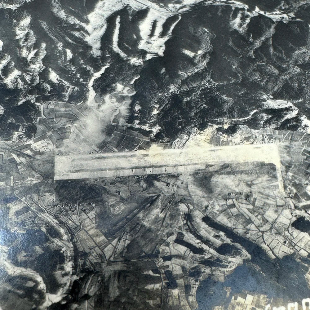
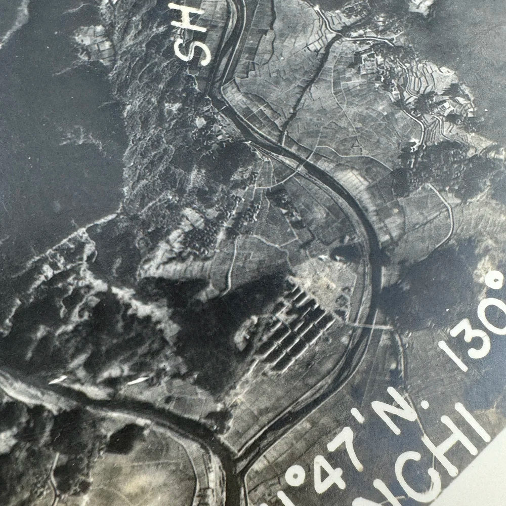
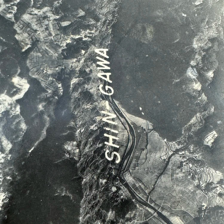
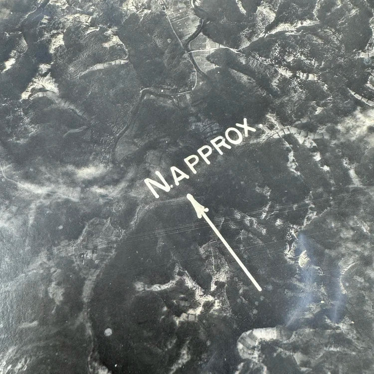
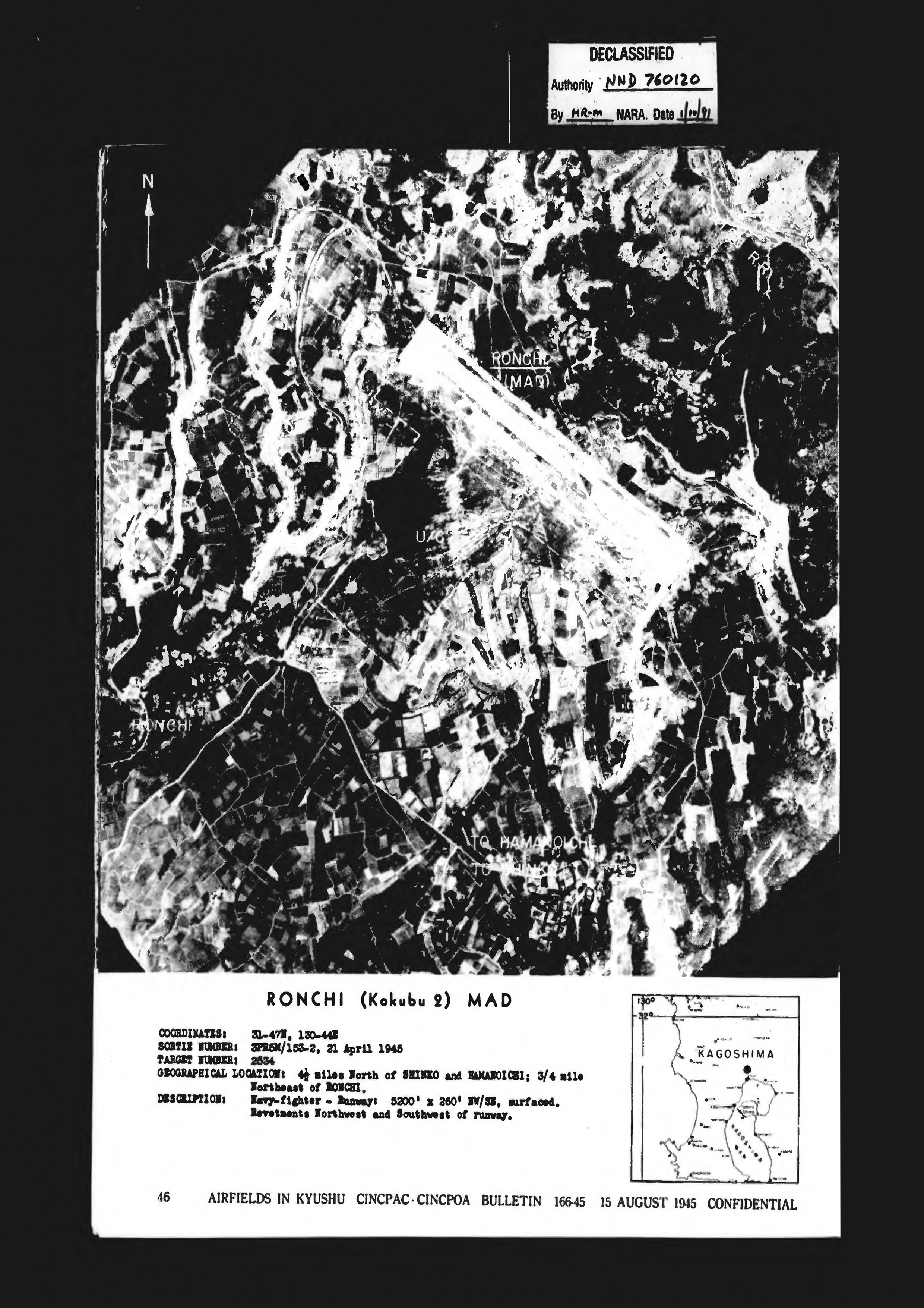
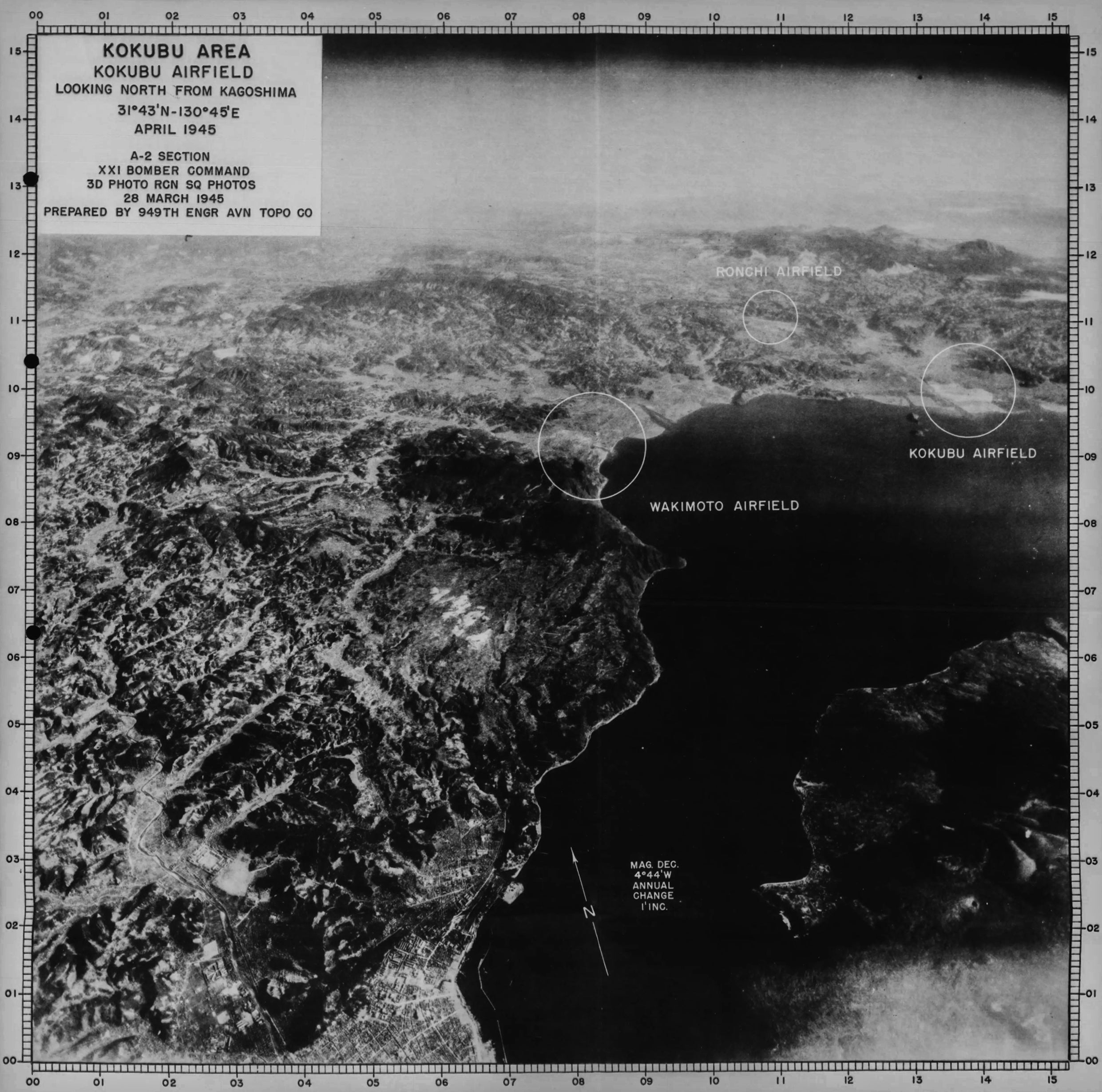
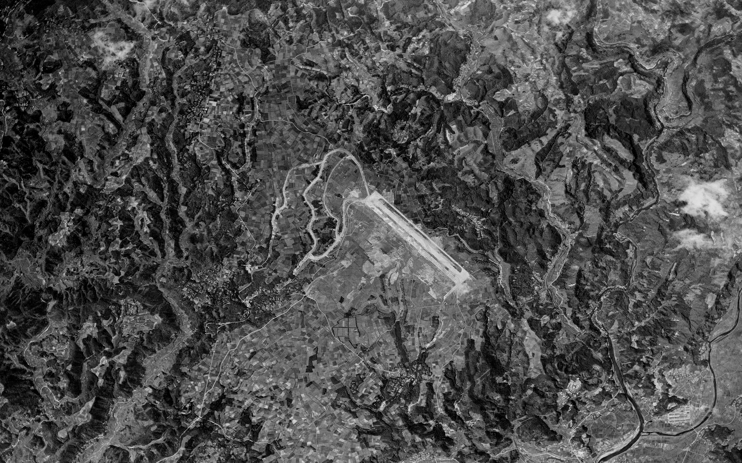
こうして、十三塚原の飛行場は、1944年(昭和19年)末に一部が完成しています。これにより、従来の国分基地は第一国分基地と名称を改め、十三塚原の基地は第二国分基地と名付けられました。当時の米軍側の資料を見ると、この十三塚原の飛行場は「RONCHI」 と呼ばれていたことが確認されています。
溝辺の十三塚原に建設された基地の工事現場には、溝辺地域の住民を中心に、鹿児島市や指宿など県下一円から、多くの勤労奉仕者が動員されていました。遠方から集まった人々は、日当山の宿舎に泊まり込み、毎日、夜明け前の薄暗い時間に出発し、現場まで続く長い坂道を歩いて通っていたと伝えられています。当時は重機などもなく、基地の建設はすべて人の手による作業で進められていました。また、高台に位置し水の少ない十三塚原では、水の確保が大きな課題となっていました。そのため、一升瓶を数本背負い、1日に4往復ほど、隼人町迫間の川まで水を汲みに行ったといわれています。


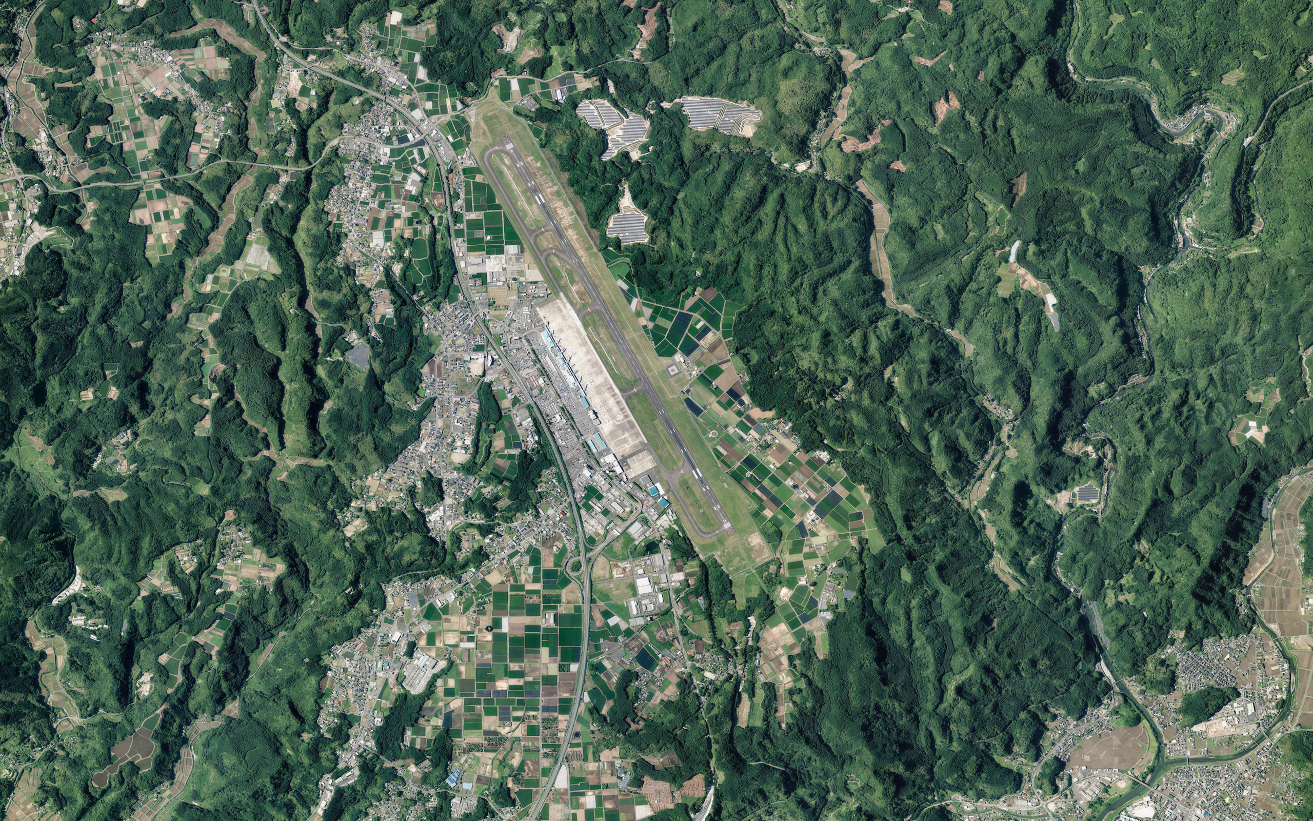
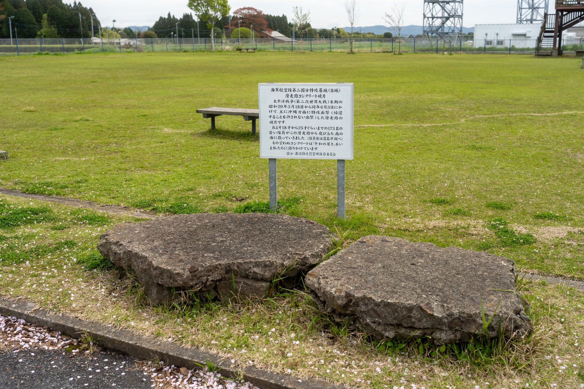

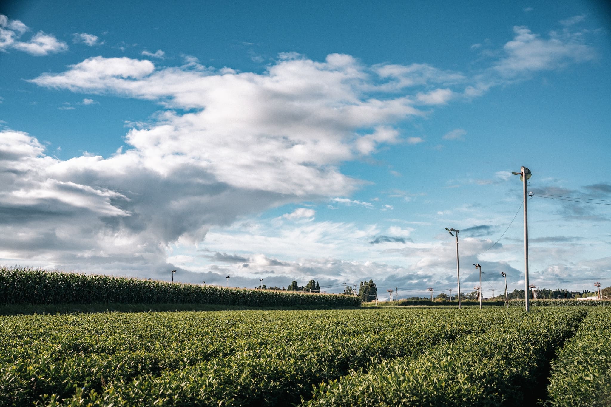
鹿児島空港の滑走路を望むその一角に、ひっそりと佇む茶畑があります。
ここには、今村茶園の原点となった在来種「やまとみどり」の株が、80年の時を重ねたいまも静かに息づいています。
戦争が終わり、この台地が少しずつ日常を取り戻していった、ちょうどその頃にあたります。前の年まで特攻機が飛び立っていた台地の上で、ひとりの女性が茶の株を植えた。今村茶園の時間は、そこから始まりました。
やぶきたをはじめとする品種茶が主流になる以前、日本の茶畑はこうした在来の株から始まっています。挿し木で増える均一な品種と違い、在来の茶は一株ごとに顔が違います。芽吹きの時期も、葉の形も、味も、少しずつ異なる。この不揃いな株たちが、四代にわたる茶づくりの出発点です。
同じ風を受けながら、ただそこに在り続ける茶畑。そっと「おかえりなさい」と囁くように、今日も葉を揺らしています。
References & Sources
Japanese Official Records
- War Diary of the 701st Naval Air Group, incl. annex: War Diary of the Kokubu No. 2 Detachment (National Institute for Defense Studies, Ministry of Defense / Japan Center for Asian Historical Records, Ref. C13120358900)
- Operational Records of the Ten Air Unit, Fifth Air Fleet, Feb.–Aug. 1945 (ibid., Ref. C16120705300)
- Combat Reports of Fighter Squadrons 302 & 303, "Air Defense of the Kanoya Area," 18–20 March 1945 (ibid., Ref. C13120282500)
- Status Tables of Naval Air Bases, Homeland Section: Sasebo Naval District (National Institute for Defense Studies)
Japanese Publications
- Tokkotai Commemoration Peace Memorial Association (ed.), The Complete History of the Special Attack Corps (2008; supplement 2011) and the Special Attack Corps Roster of the Fallen
- Iwamoto, Kiyoshi & Mukai, Tsutomu (eds.), Requiem: Ride the White Clouds Home — A Record of Kokubu No. 2 Special Attack Base (Jūsantsukabaru Special Attack Memorial Preservation Committee / Mizobe Town, 1992)
- War History Series (Senshi Sōsho): Naval Operations in the Okinawa Area (War History Office, National Defense College, Asagumo Shimbunsha, 1968)
U.S. Official Records
- CINCPAC-CINCPOA Bulletin No. 166-45, "Airfields in Kyushu" (U.S. Pacific Fleet and Pacific Ocean Areas, 15 August 1945) — public domain
- Air Facilities Supplement to JANIS 84 (Southwest Japan) (Joint Army-Navy Intelligence Study, compiled 1 May 1945) — public domain
- CINCPAC-CINCPOA Special Translation No. 65, "Digest of Japanese Air Bases" (12 May 1945 / National Diet Library Digital Collections) — public domain
- XXI Bomber Command Tactical Mission Reports, incl. Mission No. 104 (National Diet Library Digital Collections) — public domain
- U.S. Army Air Forces reconnaissance photograph, Sortie 5ME-1 (taken 1 January 1945; JICPOA annotated print, ref. 50203-46 / original negative: U.S. National Archives, Record Group 373) — public domain
Local Sources (Kirishima City, Kagoshima)
- Inscription and dedication of the Jūsantsukabaru Special Attack Corps Memorial (Uwatoko Park, erected 1979)
- Information board, Runway Concrete Fragments (Airport Park, 651-10 Kareigawa, Hayato-chō; Kokubu-Mizobe Special Attack Memorial Preservation Committee) — the figure of 173 fallen is per Kirishima City research
- Memorial information board (Uwatoko Park, 1997, Mizobe Town Special Attack Memorial Preservation Committee)
- On-site guide map, "Special Attack Base: Kokubu No. 2"
Images
- U.S. military aerial photograph USA-M57-261 (19 April 1946, 1st Reconnaissance Squadron, Eighth Air Force): adapted from the Geospatial Information Authority of Japan (GSI) Map & Aerial Photo Viewing Service
- Present-day aerial imagery: adapted from the Geospatial Information Authority of Japan (GSI) aerial photographs.
Film
- "Japanese Pilots; Dive Bombers; Aerials of Dive Bombers in Flight" (1943, captured Japanese footage): U.S. National Archives, via Internet Archive — public domain
- U.S. Navy footage, March–April 1945, waters off Kyushu and Okinawa (Naval Photographic Center collection, NPC-11125 / 11173 / 11213 / 11164 et al.): U.S. National Archives, via Internet Archive — public domain
About This Project
Company
IMAMURA TEA PLANTATION
Founded 1947
Address
655-15 Karegawa, Hayato-cho, Kirishima-shi, Kagoshima 899-5113 Japan
Contact Information
Tel 0995-43-9162
Fax 0995-43-9260
Hours of Operation
10:00 – 17:00
Closed on Sundays and National Holidays
Tea Master:Hirotsugu Imamura
When I face the craft of tea, I always hold on to a sense of “freedom.”I listen to the voice of nature, break away from fixed forms, and quietly explore the possibilities within each cup.
Producer:Yoshihiro Shimazu
Tea takes me places I never expected—beyond landscapes, beyond time, and sometimes even beyond myself.It keeps leading me forward, and I keep following.
Branding:I.T.P.entertainment
We deliver emotion through stories and tea, crafting moments that stay with you.
Certifications & Qualifications
有機JAS農産物生産工程管理者 認証番号: 1097
有機JAS加工食品生産工程管理者 認証番号: 加工 1108
ASIAGAP Certification Number: MIC-S-A460000095
PRESENTED BY
IMAMURA TEA PLANTATION
© all rights reserved